Caer Estyn, Flintshire
Demolished chapel


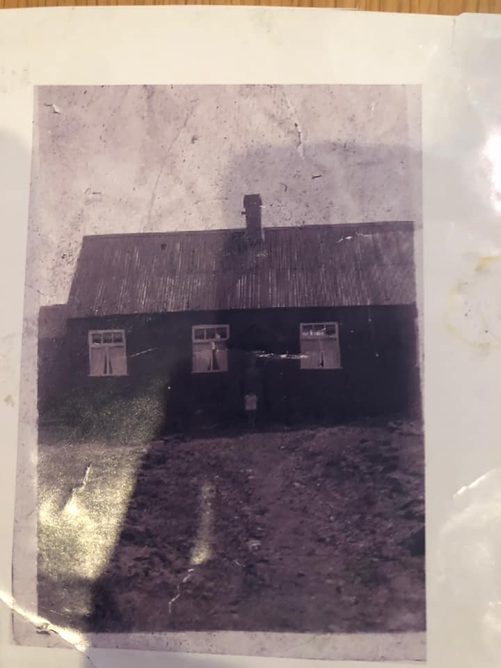
The 1912 25-inch Ordnance Survey map marks a Primitive Methodist chapel in Caer Estyn at grid reference 381 575. A 92-year-old man living nearby remembers it as a tin chapel, and says it became a dwelling perhaps about the time of the Second World War.
I have not found the chapel in any old Circuit Plan. Any further information would be of interest.
Heather Tamaris Cunnah has provided the following information (May 2021):
Built in 1862 and demolished around 1982. The chapel became a dwelling place around the time of WWII and Mr Hughes resided there. Then Jim Williams, and after, Sammy the Gwastad. It was then demolished and a house built in its place next to Bryn Arthur. Some of the congregation are buried in the field behind the house that is owned by Miss Parsonage who lives in one of the stone cottages.


Comments about this page
Local history people tell me:
– the chapel was green, and an old man named Sammy lived there
– the chapel was pulled down and a house built on the site in 1983, where 53 Rhyddyn Hill is now
– the 1909 OS map shows the local of what it labels “Meth Chap”.
I have now found an old Plan at Chester county record office, with Caer Estyn mentioned in the Second Circuit (Hunter Street) Circuit.
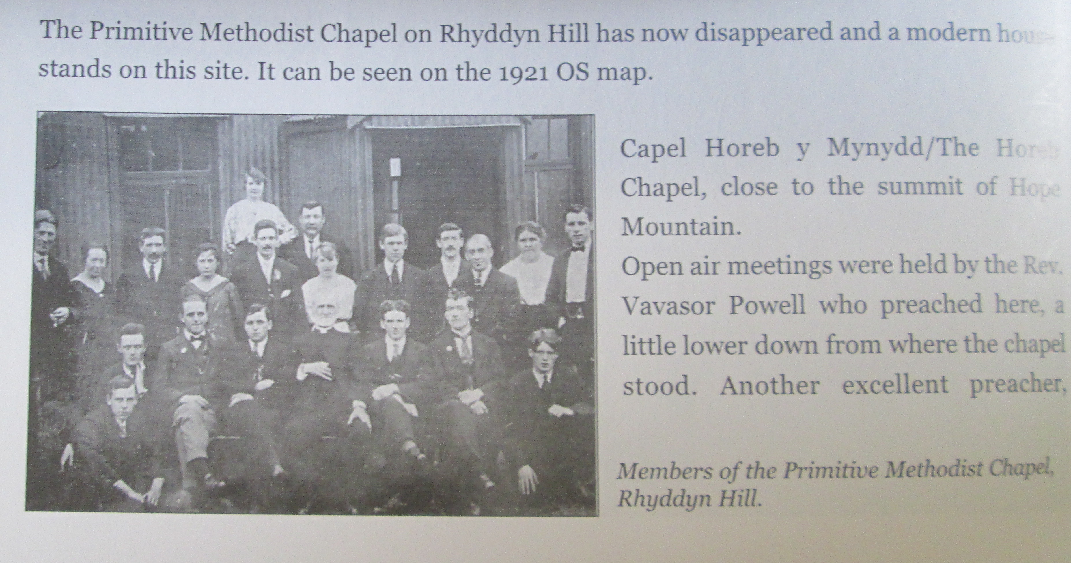
There is a photograph of the minister and others outside the chapel in a book called “A History of Hope and Caergwrle” by Phoenix & Matthews.
Elderly Methodists at the ex-Primitive chapel in nearby Caergwrle also remember the tin chapel. I have not discovered which circuit it was in.
Add a comment about this page