

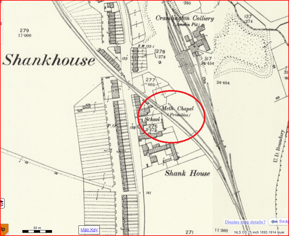
John Walley has located a Primitive Methodist chapel at what was known as Shankhouse, in north east Cramlington. In 2024, the area is a mixture of grassland and woodland, but the 1895 Ordnance Survey map shows long rows of terrace houses serving the Amelia Pit of Cramlington colliery. In addition to the Primitive Methodist chapel, there was a Wesleyan Methodist chapel and a Mission Hall. Both Methodist chapels are still there by the 1922 map.
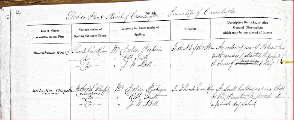
The chapel appears in the Name Book compiled by Ordnance Survey mappers in the 1850s. They describe it as:
A small building used as a chapel by the Primitive Methodist also a private day school.
Authority for the spelling of the name was given by Mr Dobson Pickerin, Mr Robert Smith and Mr JW Bell.
What’s the story?
Chapel located at Ordnance Survey grid reference: NZ 2769 7798
John’s sources were:
- OS Names Book ( a goldmine for PM chapels and mining info for me)
- NLS Maps
Comments about this page
I came across a book this morning, “The history of the Primitive Methodist Church, Vol. 1”, by Kendall that features a lovely handwritten dedication in the inside front cover from the “Members of the Shankhouse Primitive Methodist Church” dated 18 August 1906 and “presented to Mr & Mrs Richard Cann of Cramlington in recognition of their connection with, and valuable services to, that church during a period of about forty years”.
It’s a nice piece of history and perhaps we could donate it an appropriate denominational Archives or Primitive Methodist museum?
Add a comment about this page